Introduction
The historic district of Satara in south-western Maharashtra is small, constituting just 3.4 per cent of the state’s total geographical area and 2.4 percent of its population. But it is a land of immense geographical variation, ranging from mountains and lush forests to heavily cropped farmland and low-lying scrubland.
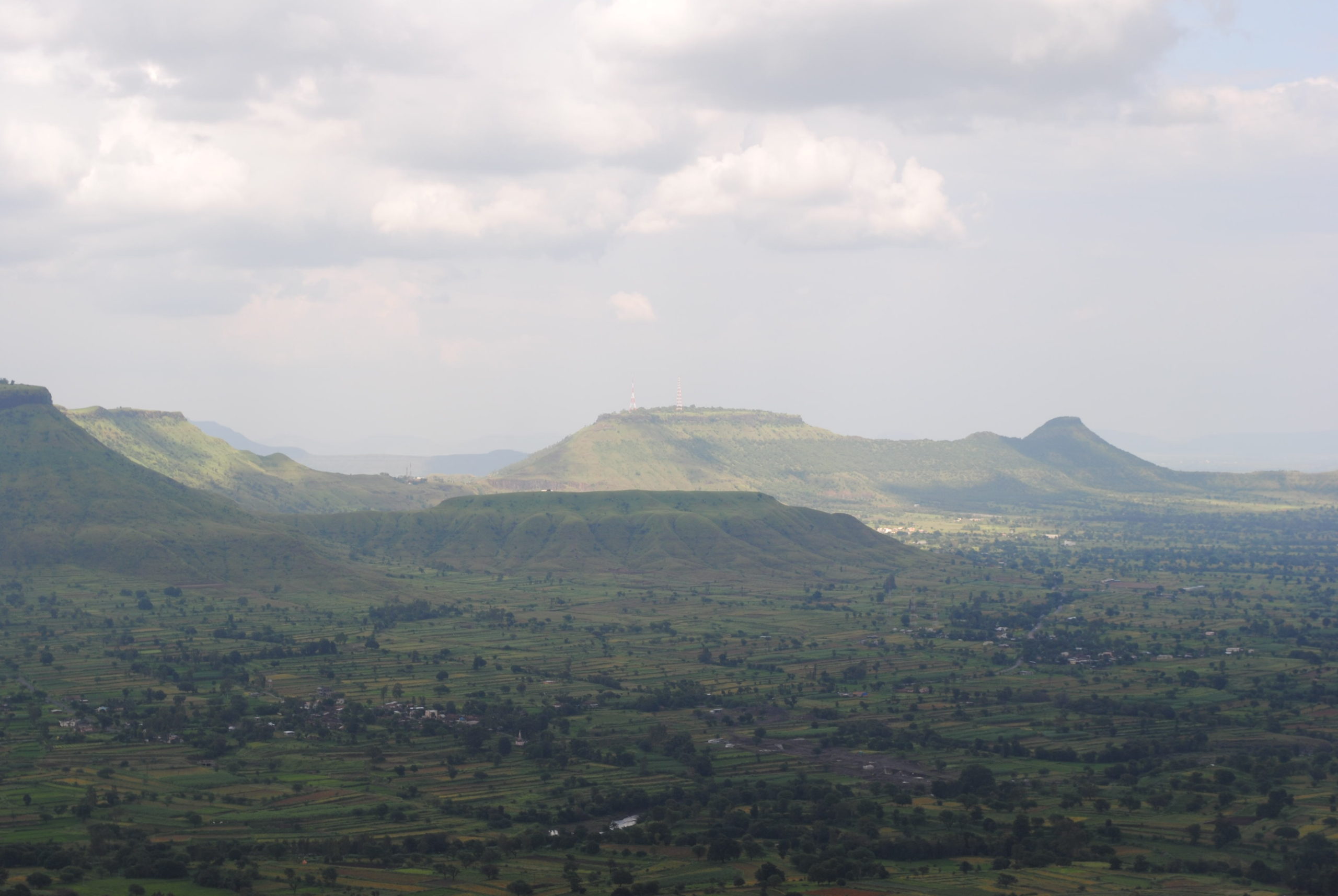
The Sahyadri range runs north and south along Satara’s western edge, while the Mahadeo range, with its fortress-like formations of black rock, stretches east and south-east across the district from its starting point near the hill stations of Mahabaleshwar and Panchgani, where the mighty Krishna river also starts its long journey across the country.
The whole of Satara district falls in what is known as the Deccan Traps, flat-lying basalt flows of volcanic lava topped with laterite, but further east, the most common soil is the black loamy clay, rich with carbonate of lime, which, when well-watered, is capable of yielding heavy crops.
Satara’s rocky plateaus, at an altitude of 1,000 to 1,200 meters above sea level, are a unique ecomorphological entity, representing one of the world’s few existing clusters of rare laterite.
Sajjangad view from yavteshwar plateau Picture Credits: Aparna Watve
The thick ironstone cap of the plateaus is very resistant to erosion by surface runoff or by channelized flows and has a very thin soil cover, which influences the vegetation and ultimately the biodiversity here.
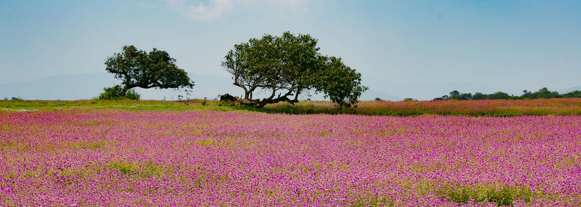
Depending on the depth of the soil, the rocky plateaus support a matrix of low thickets of woody vegetation and shallow ephemeral wetlands and grass. The plants that grow on these rocky plateaus are specially adapted to growing in shallow and nutrient-limited acidic soil that is low in phosphates. More than 300 different plant species flourish here during the monsoons, making the land a carpet of flowers.
The ephemeral wetlands on the rocky plateaus, including shallow rock pools, streams and watercourses, also support a rich diversity of endemic fauna such as fish, amphibians and insects.
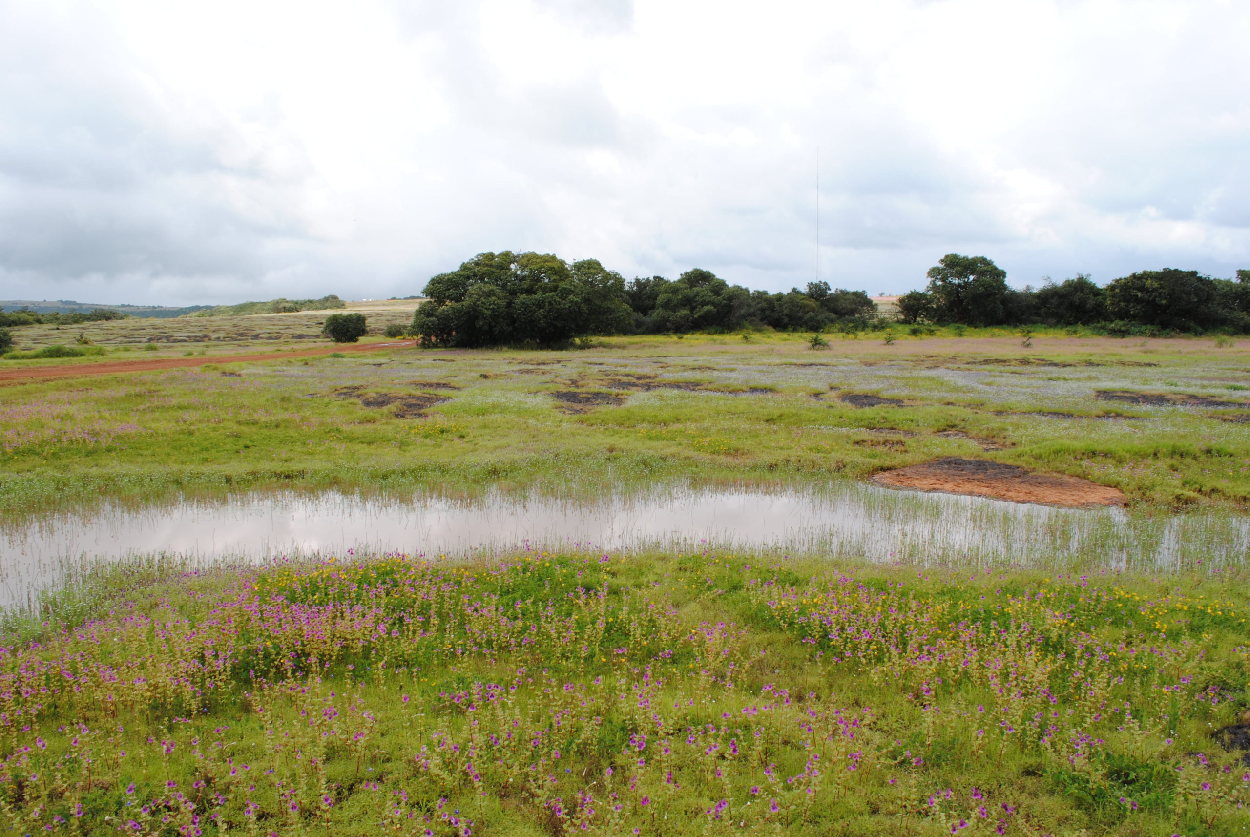
Ephemeral wetland on Kaas plateau during the monsoons Picture Credits : Aparna Watve
Satara district has 677 species of wildlife, 94 of them endemic, 35 listed as threatened in the International Union for Conservation of Nature red list, and 38 listed in different schedules of Indian Wildlife (Protection) Act 1972 (as amended up to 2013).
Some species of wild anima use the rocky plateaus as a corridor during migration, others use the large crevices underneath as a breeding ground. The plateaus also serve as a grazing ground for wild herbivores such as the Indian bison and deer.
In 2018, BEAG was instrumental in having three clusters of rocky plateaus in Satara district designated in the Regional Plan of Satara District as a Conservation Zone: the Kaas plateau, the Chalkewadi-Patan plateau and the Mhavashi-SadaVaghapur plateau.
History
The district of Satara has an ancient history. Historical inscriptions as old as 200 BC mention the town of Karad. It is also believed that the Pandavas stayed in Wai town in the 13th year of their exile.
Around 450 AD, Satara district became part of Chandragupta Maurya II’s empire. The Satvahanas ruled the district for two centuries beginning in 550 AD. Then followed rule by the Chalukyas, the Rashtrakutas, the Shilaharas, the Yadavas of Devagiri, the Bahmanis, the Adil Shahis, the Marathas, the Mughals, and the British.
Satara was the capital of Maratha kingdom. In 1663, Shivaji won Satara fort from the Mughals, but after his death, it fell into the hands of Aurangzeb and later Parshuram Pratinidhi. In 1708, Chattrapati Shahu was crowned at Satara fort.
The British Empire annexed most of the Maratha territory to the Bombay Presidency after their victory in the Third Anglo-Maratha War in 1818. But they restored the titular kingship to Raja Pratap Singh and assigned to him the principality of Satara, an area much larger than the present district.
Political intrigues resulted in Pratap Singh being deposed in 1839 and his brother Raja Shahaji being placed on the throne. When the prince died without a male heir in 1848, Satara was annexed by the British government and included in the Bombay Presidency.
The direct descendants of Shivaji continue to live in Satara.
The Need for Conservation
Satara district has always been of special interest to BEAG.
BEAG had worked for decades to have Satara district’s Mahabaleshwar and Panchgani area to be declared an Eco-Sensitive Zone by the Government of India.
While the Government of India had recognized the need to protect and conserve the Mahabaleshwar-Panchgani area by declaring it an Eco-Sensitive Zone, Satara district’s unique rocky plateaus were still in need of protection.
BEAG requested the state government of Maharashtra to declare the clusters of three rocky plateaus in Satara district a Conservation Zone under the state’s MRTP Act. The state government confers Conservation Zone to areas that are of ecological and environmental importance or of natural beauty worthy of preservation, conservation or restoration.
Without protection, the rocky plateaus and the biodiversity they supported would not survive, BEAG was convinced.
Although the rich biodiversity on the rocky plateaus has a high percentage of endemic species, the seasonal nature of the habitat and the lack of woody plants had caused them to be classified as ‘barren lands’ in the Wasteland Atlas of India. The classification opened the door to many developmental projects that had no regard for the ecological uniqueness of the rocky plateaus.
Things changed in 2012. Kaas plateau, relatively unknown in India, was declared a UNESCO World Natural Heritage Site in 2012. The ecological significance and beauty of Kaas plateau had been internationally acknowledged, but the recognition did not come without a fallout. The number of tourists visiting the plateau suddenly increased to such an extent that there was a real danger of Kaas being ruined due to trampling and litter.
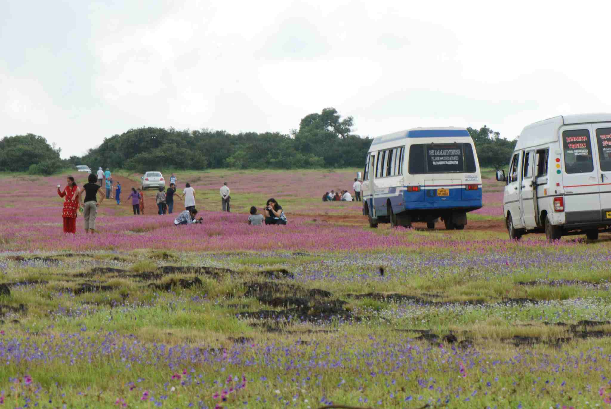
Kaas being ruined due to trampling Picture Credits : Aparna Watve
India’s laws protect animals, wild life, flora and fauna, as well as man-made monuments and archaeological sites but not unique geo-morphological sites such as the plateaus of Satara district. Most of the natural wonders in the country are protected largely because they happen to be located within protected forest areas. Many sites located outside forests and protected areas have already been destroyed or are likely to be destroyed due to unplanned development activities or sheer neglect since they are not legally recognized as natural or cultural heritage sites.
Satara Regional Plan
In 2015, BEAG started working with the Biome Conservation Foundation (BCF) to prepare a conservation management plan for the rocky plateaus of Satara district, which had by then been designated a conservation zone within the Mahabaleshwar-Panchgani Eco-Sensitive Zone (ESZ).
The rocky plateaus had been surveyed in an extensive ecological study of the Western Ghats conducted under the guidance of BCF ecologist Dr. Aparna Watve. The year-long study, completed in March 2013, had been funded by the Critical Ecosystem Partnership Fund (CEPF), an international fund for the protection of highly sensitive ecological areas.
The CEPF study had not only documented the biodiversity and ecosystem services on the rocky plateaus but had also identified threats and provided critical suggestions for the local management of the plateaus.
Using the CEPF study as the basis, BEAG collaborated with BCF to formulate a detailed conservation management plan for the three rocky plateau clusters.
When Satara district started to formulate its own regional plan for areas outside the Mahabaleshwar and Panchgani ESZ, BEAG sent the conservation management plan it had formulated with BCF to the Land Use Committee of the Satara Planning Board, requesting that the three rocky plateau clusters be designated a Conservation Zone within the Satara District Regional Plan.
The BEAG-BCF conservation management plan provided a detailed road map for the local administrative authorities to put in place strategies for the sustainable use of land, water and other natural resources in the rocky plateau region based on mapping of spring-sheds, watersheds and agrarian cropping pattern in the villages inside the core area of the rocky plateaus as well as those just beyond the steep escarpments.
The conservation management plan also provided strategies for involving the local community to reconnect with the unique natural heritage site and participate in its protection and conservation. In order to motivate the community, the plan suggested the restoration of the temple and the sacred grove, devrai.
The plan also contained a detailed Development Control Regulation (DCR) for each of the three rocky plateau clusters that included a scientific management plan for ecological assets and the needs of the local populations.
BEAG hopes that its conservation management plan’s flexible and multi-pronged approach, which takes into consideration several dimensions such as the social dynamics between local stakeholders, local authorities, tourists, and the specificities of the local eco-system, could become a template for other similar clusters of plateaus located near Trimbakeshwar, NaneghatJunnar and over a dozen more sites along the Western Ghats in Maharashtra.
BEAG believes, Plans that are based on symbiotic collaborative partnerships between researchers, conservationists, local and regional governing bodies, and local stakeholders have the best chance of success at conserving natural and cultural heritage sites around the country.
Rocky plateaus included in the Conservation Zone
In 2015, BEAG requested the Satara district administration to declare three rocky plateau clusters in the district a Conservation Zone—the Kaas plateau (15.51 square kilometres), the Chalkewadi-Patan plateau (54.93 square kilometres) and the Mhavashi-SadaVaghapur plateau (14.2 square kilometres)
The Satara Planning Board suggested that BEAG start by presenting its case to the its Land Use Committee. On June 9, 2015, BEAG gave a detailed presentation to the Land Use Committee on the need to include the three clusters of rocky plateaus in the Conservation Zone in the Satara Regional Plan.
Based on the recommendation of the Land Use Committee, on February 17, 2016, BEAG was invited to make a presentation before the Satara Planning Board.
The Satara Planning Board accepted BEAG’s Conservation Zone proposal in principle and requested BEAG to provide additional details to the state’s Study Group for Environment, Tourism and Heritage.
In 2017, BEAG’s Conservation Zone proposal was finally endorsed and forwarded to Satara district’s Office of Town Planning for inclusion in the Satara draft Regional Plan.
BEAG was invited by the Satara Planning Committee to work with the sub-committee finalizing the regulations and submission to the Regional Planning Board.
On March 30, 2017, the draft Regional Plan was published by the state Urban Development Department (UDD) for public suggestions and objections.
As part of its suggestions and objections, BEAG submitted a detailed Conservation Zone Management Plan and also attended the hearing of the Satara Planning Committee on August 21, 2017.
BEAG had already started proactively to work with the Office of Town Planning to formulate the Development Control and Promotions Regulations (DCPRs) for Satara District and to prepare, with the help of an architect firm, village maps demarcating the planned conservation zone.
The final Regional Plan for Satara district was published on October 14, 2018. The plan designated the three rocky plateau clusters a Conservation Zone. BEAG’s hard work and persistence had paid off.
Threat of Quarrying
Back in 2016, when BEAG was making site visits with BCF to the rocky plateaus to formulate its conservation management plan, BEAG noticed unauthorized quarrying being carried out on the SadaVaghapur plateau, height 1,000 metres. The quarrying was being done on private land in Dhadamwadi village, Patan Taluka, near the Mauli temple. Locals informed BEAG that that the quarrying had started two years ago.
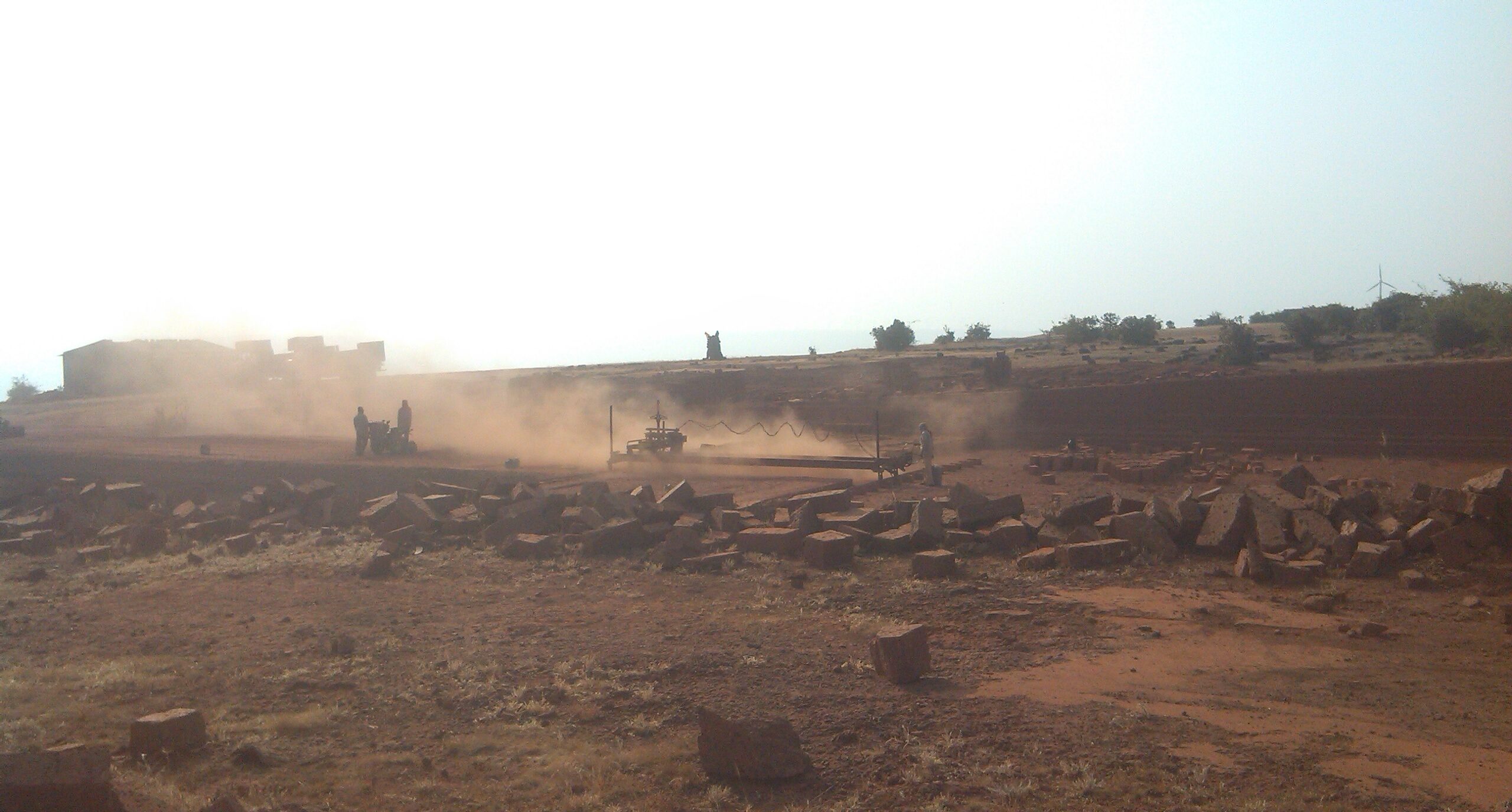
laterite quarrying sadawagapur Picture Credits: BEAG ARCHIVE
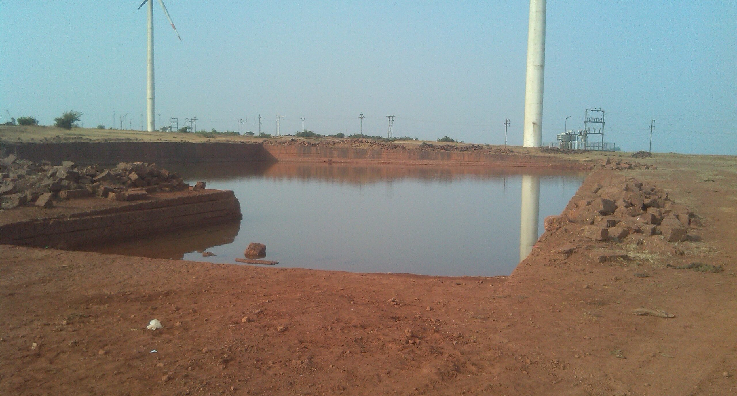
Water tank within the quarried area Picture Credits: BEAG ARCHIVE
BEAG filed a formal complaint with the Satara Collector, requesting action against the violators.
Due to BEAG’s persistent follow-up, a show cause notice under the Maharashtra Land Revenue Code, 1966, section 48 (7), was issued to the violators on April 7, 2017, asking why they should not be fined for their illegal actions.
After conducting a hearing, the PatanTahsildhar passed an order fining the violators Rs. 31,904,800. The order also noted that the violators had already paid a fine of Rs. 55,000 two years earlier, on October 14, 2015, for unauthorized quarrying.
BEAG continues to be vigilant in Satara and hopes that the protection accorded to the rocky plateaus by the status of Conservation Zone saves these ecologically fragile sites.
Satara Heritage Lists and Regulations
Heritage List
Of the 149 heritage assets listed in the draft notification published for public suggestions and objections by the Satara Municipal Council on January 31, 2013, only 38 heritage assets made it to the final draft published on August 14, 2014.
BEAG requested the Government of Maharashtra to reinstate at least another 38 of theassets that had been excluded in the final draft of the notification. The 38 assets BEAG was recommending for inclusion were of three types: Assets under the ownership of the government, assets under religious and institutional use, and natural assets.
BEAG’s request to reinstate the 38 excluded assets in the final draft of the notification were forwarded on July 22, 2015 by the Government of Maharashtra to the state Director of Town Planning in Pune, which sent in on to the Assistant Director Town Planning(ADTP), Satara, requesting a report within 15 days. The ADTP, in turn, sent it to the Satara Municipal Council for its report.
BEAG’s request was in the bureaucratic maze.
Luckily, the Heritage Conservation Committee (HCC) for the Mahabaleshwar Panchgani Eco-Sensitive Zone (MPESZ) and the areas governed by the municipal councils of Satara, Wai, Panchgani and Mahabaleshwar was reconstituted on June 2, 2016.
BEAG wrote to the newly reconstituted HCC, urging it to consider its request to reinstate the deleted sites based on their merits, pointing out that when the Satara Municipal Council had finalized the heritage asset list, the HCC had not been constituted, which meant that no heritage experts had been involved in the decision-making.
The HCC invited BEAG to present its case at the next HCC meeting.
On August 4, 2018, BEAG gave a detailed presentation at the HCC meeting. By this time, BEAG had pared down its list to 30 sites.
At the end of the meeting, the HCC made the decision to constitute a sub-committee of its heritage conservation experts to conduct a site visit to all the 30 sites along with BEAG and to submit a report on its findings.
After the final site visit on October 5, 2018, the HCC sub-committee submitted its report to the HCC on October 24, 2018. Of the sites proposed by BEAG for addition, 27 sites were recommended by the subcommittee.
The Satara Municipal Council published the list of 27 additional sites for public suggestions and objections. But one year later, in December 2019, the Satara Municipal Council stated that it had received objections from owners about four sites in the HCC recommended list on the grounds that they had no heritage value and were within certain developments.
After much discussion, the HCC unanimously decided to retain three of the four sites to which objections had been raised.
Altogether, 26 initially excluded sites have been now recommended for inclusion within the Heritage List.
Heritage Regulations
The final Heritage Regulations for Satara Municipal Council were published by the state Urban Development Department (UDD) on January 9, 2013.
On close examination of the regulations, BEAG found several omissions and errors and pointed these out to the UDD as the HCC had not then been constituted.
When the HCC was constituted in 2016 , BEAG drew the attention of the HCC to the errors. The HCC directed the Chief Officer of the Satara Municipal Council to initiate action under the MRTP Act (Section 37) and to incorporate BEAG’s suggestions for corrections and inclusions. But no action was taken by the Satara Municipal Council.
BEAG then made a detailed comparative analysis of five final heritage regulations in force within Satara district—the councils of Mahabaleshwar, Panchgani, Satara and Wai, and the non-municipal areas of Mahabaleshwar Regional Plan areas, all of which are within Satara district, have one HCC but differing heritage regulations.
BEAG presented its comparative report to the HCC at its meeting on September 13, 2019.
The HCC accepted BEAG’s corrections and suggested changes. The HCC will be communicating its decision to the state government, which will then need to follow the process specified in the MRTP Act to have BEAG’s corrections and suggested changes incorporated into the Development Control Regulations.